Editor’s Note: The following editorial was provided by the Pennsylvania Department of Transportation..
The Pennsylvania Department of Transportation (PennDOT) District 2 recently debuted an online, interactive story map for the Potters Mills Gap Transportation Project (PMG) on Route 322, in Centre County. The story map is part of an innovative, creative effort to mitigate project impacts on historic resources in the project area.
As designed, the story map satisfies a portion of the mitigation requirements for adverse effects to the Penns/Brush Valley Rural Historic District identified as being eligible for listing on the National Register of Historic Places (NRHP). The Story Map, titled A Journey to Potters Mills, is the first of its kind to be used by PennDOT as mitigation for adverse impacts to historical resources. The PMG project had an impact on several wooded tracts, historic buildings, and historic farmland areas within the Rural Historic District. It was determined that the character defining features of the Rural Historic District in the Potters Mills area would be adversely affected by the project.
The story map, produced by historical specialists from McCormick Taylor, Inc., displays the locations and details about various historically significant sites, people, and events within the project area. Viewers accessing the web-based mapping of the project area may explore the rich history by a simple mouse click.
“The intent of the Story Map is to provide the public with insight into how the development of transportation within the Potters Mills Gap has, over time, impacted the Historic District,” said Karen Michael, PennDOT District 2 Executive.
The McCormick Taylor project team consulted with various other organizations to collect the information displayed within the map. The project team sought images which spanned the development of the area, and included diverse subjects and formats including photos, historic maps, portraits, documents, and other records.
In order to find images and information for the Story Map, the project team conducted research at a number of repositories, including the Centre County Historical Society, Penns Valley Area Historical Museum, New York Historical Society, Princeton University Undergraduate Alumni Records, Pennsylvania State Archives, Centre County Library & Historical Museum, and Pennsylvania State University. Content for the Story Map was also sourced from several state agencies including PennDOT, PA Department of Cultural and Natural Resources’ (DCNR), Rothrock State Forest and Bureau of Forestry’s Penn Nursery, and PA State Historic Preservation Office (SHPO).


A Journey to Potters Mills can be found on PennDOT’s PA Project Path website, here.
More information about the PMG Transportation Project is available on the project web page:
The Penns/Brush Valley Rural Historic District was determined eligible for listing in the NRHP in 2002 based on its agricultural patterns and associated landscape features established during the nineteenth and twentieth centuries. Eligibility is also based on the nineteenth and twentieth century Vernacular-style architecture found on the rural historic district’s farms and within the villages of the valleys. The period of significance for the district extends from c. 1800 to 1940. The district is located within the Ridge and Valley region of Pennsylvania and occupies Penns Valley and Brush Valley, in Centre County.
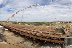
The purpose of the PMG project is to improve safety, reduce congestion, and alleviate access concerns along the section of Route 322 from the Centre County/Mifflin County line to west of the Route 322/Route 144 intersection at Potters Mills. Section B04 (the Bridge over SR 322), the first of three construction sections of the PMG project was completed on September 23, 2015. Section B05 (Sand Mountain Road Interchange at Seven Mountains) began construction in August 2016. The last section, Section B06 (4-Lane Extension and Western Interchange) is currently in Final Design and is scheduled for a fall 2017 construction start.